Appearance
Import GPR Files
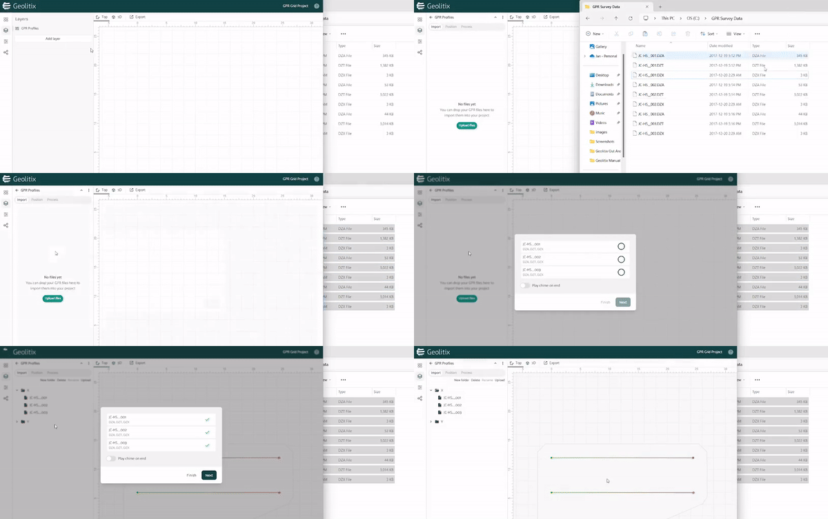
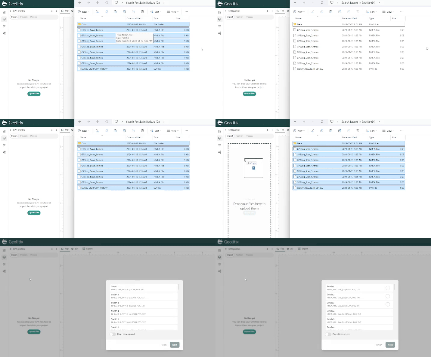
Geolitix was designed to make importing your data as simple as possible using the simple drag-and-drop functions you use on your computer. When importing data, all of the data contained in a project directory must be imported at the same time. Most GPR manufacturers use data files along with header files, GPS files and sometimes project geometry files. Geolitix is completely agnostic and can accept data from all major GPR manufacturers, as well as industry standard SEGY formats.
A check mark will appear beside each file when successfully uploaded to Geolitix. Files which produce errors, or files which are not needed result in a red cross. Errors are mostly likely due to a missing file.
Geolitix automatically determines if the GPR project was collected with a GPS, total station or using a regular grid pattern. This is done by analyzing the imported data to determine if positioning information is present. Project files from Malå ObjectMapper, Sensors and Software GPZ projects, IDS C-True and other files which may not contain GPS or total station positioning but do contain grid geometries and radar markers are imported and positioned properly in Geolitix.
The GPR Layer allows for the import of GPR files, positioning options for those files and GPR processing.
Since Geolitix is primarily GPR processing software, any new project must have at least one GPR layer. However, projects can contain more than one GPR layer. This is particularly useful when a project contains data from different GPR systems (e.g., different antennas or manufacturers).
For such projects, each dataset should usually be processed separately as the processing steps may differ for each GPR layer. Note that all data is contained in a single GPR layer for dual-frequency radar systems consisting of a single unit (e.g., ImpulseRadar CrossOver, PinPointr, IDS systems, GSSI dual-frequency).
Importing field interpretations
Field interpretations made during data acquisition can be imported from Malå Geoscience, ImpulseRadar and Sensors and Software systems by dragging these interpretation files concurrently with the GPR data.

Accepted formats
The files which are expected by Geolitix vary depending on the specific GPR manufacturer, as shown below.
Geoscanners AB
*.gsf
GeoTech Russia
*.gpr or *.gpr2
GPRMax
*.out
GSSI
*.dzt, *.tmf, *.plt, *.dzg,
IDS
*.dt, *.geo, *.svy, *.gps, *.nmea
Note: For Stream systems drag and drop the entire Data folder along with the *.nmea files (for GPS projects).

ImpulseRadar
*.iprh, *.iprb, *.tsp, *.cor
Kontur (formally 3D-Radar)
*.vol
Malå Geoscience (Guideline Geo)
*.rd3, *.rd7, *.rad, *.pos, *.obm, *.cor
Proceq (Screening Eagle)
*.sgy, *.csv
ReflexW
*.xxR, *.xxT from the PROCDATA directory
Radsys
*.sgy
Sensors and Software
*.dt1, *.hd, *.gpz, *.gps
Note: GPZ files should be opened once in the Sensors and Software program before importing into Geolitix.
SEGY
*.sgy
Transient Technologies (VIY)
*.sgpr
USRadar
*.rad, *.ra#, *.gps
Utsi Electronics
*.dat, *.hdr, *.gps, *.gpt
VIY (Transient Technologies LLC) *.brm
files required for GPS positioning
INFO
Contact us at support@geolitix.com if you would like help with these or other formats.